I was supposed to go hiking in the San Gabriel mountains today, but the person who was going to come with me is a little under the weather. I was already in hiking mode though, so I decided to go alone, only something closer. I did a little googling until I read about Peters Canyon Regional Park in Orange which was described as 5.5 miles long, elevation gain of only 500 ft., and "moderate" difficulty. So, not that great, but I figured better than watching another Lifetime movie so I went to go check it out. Here's a picture from the parking lot:

The visible homes on the other side of the lake, and the hum of the freeway in the background don't exactly leave you feeling like you've ventured into a wilderness area, but all things considered, not so bad.
The first mile or so was really flat and I was starting to feel annoyed that I'd worn my hiking shoes just to walk along a dirt path. Then I turned a corner and there was a really steep hill that seemed to have just come out of nowhere. I had read a review from some lady (who admitted to being in very poor shape) who complained that the hills were very steep and left her so winded that she had a hard time getting to the top. I was also worried about not making it to the top, but not because I was getting winded. The hill was covered in very fine sand. The bottom layer was packed down hard, but there was a substantial layer of loose sand on top that made me feel like I was going to slip and face plant. About halfway up I was feeling kind of sweaty and just kept picturing myself falling sweaty face first into that sand and getting up with it stuck all over me like some sort of mud mask. Here's a picture of the dirt on a descending portion of the trail. Really I just took this picture because I liked how it was all different colors, which you can't really see all that well. What can I say? I'm not a photographer.

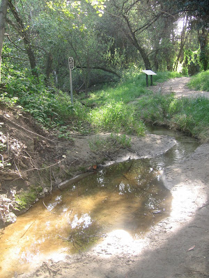
I detoured over onto a side trail for a while to check out the little creek, which was my favorite part of the hike. I love streams and rivers, they fascinate me and I can't even tell you why.

 I would say a good 30% of the hike looks every bit as flat as this picture:
 You can't really tell from the picture above, but there are two hills here, with a big dip between them. The whole last half of the hike was like that. It wasn't too bad a lot of steep hills like the one above, but then you go back down on the other side, and then up and then down again, repeated several times until you get back to the flat part of the trail for the last half mile or so.
 It wasn't exactly the hike I had hope for today, but it was still nice to get off of the pavement and cement for a few hours.
No comments:
Post a Comment